
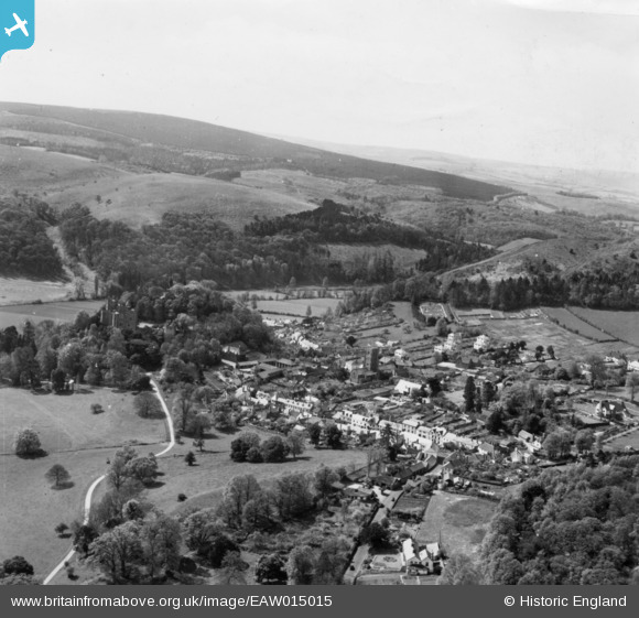
EAW015015 ENGLAND (1948). The village, Dunster, from the north-east, 1948. This image has been produced from a print.
© Copyright OpenStreetMap contributors and licensed by the OpenStreetMap Foundation. 2026. Cartography is licensed as CC BY-SA.
Nearby Images (7)
EAW015015

EPW033723

EPW033721

EPW033722

EAW015009

EPW033234

EPW033231

Details
| Title | [EAW015015] The village, Dunster, from the north-east, 1948. This image has been produced from a print. |
| Reference | EAW015015 |
| Date | 27-April-1948 |
| Link | |
| Place name | DUNSTER |
| Parish | DUNSTER |
| District | |
| Country | ENGLAND |
| Easting / Northing | 299227, 143780 |
| Longitude / Latitude | -3.4420107091498, 51.183835809592 |
| National Grid Reference | SS992438 |
Pins

PhotosOfThePast |
Friday 12th of June 2026 06:19:01 PM | |
|
PhotosOfThePast |
Friday 12th of June 2026 06:18:05 PM | |
|
PhotosOfThePast |
Friday 12th of June 2026 06:17:40 PM | |

Class31 |
Monday 29th of September 2014 10:43:20 PM |
