
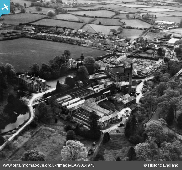
EAW014973 ENGLAND (1948). Stowford Paper Mills and environs, Ivybridge, 1948. This image has been produced from a print.
© Copyright OpenStreetMap contributors and licensed by the OpenStreetMap Foundation. 2026. Cartography is licensed as CC BY-SA.
Nearby Images (7)
EAW014973

EAW014974

EAW014977

EAW014976

EAW014978

EAW014972

EAW014975

Details
| Title | [EAW014973] Stowford Paper Mills and environs, Ivybridge, 1948. This image has been produced from a print. |
| Reference | EAW014973 |
| Date | 27-April-1948 |
| Link | |
| Place name | IVYBRIDGE |
| Parish | IVYBRIDGE |
| District | |
| Country | ENGLAND |
| Easting / Northing | 263674, 56561 |
| Longitude / Latitude | -3.918121959228, 50.392495756116 |
| National Grid Reference | SX637566 |
Pins
Be the first to add a comment to this image!