
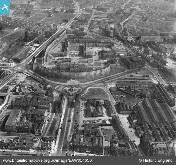
EAW014656 ENGLAND (1948). Quarry Hill, Leeds, 1948
© Copyright OpenStreetMap contributors and licensed by the OpenStreetMap Foundation. 2026. Cartography is licensed as CC BY-SA.
Nearby Images (15)
EAW014656

EAW015996

EAW046761

EAW028063

EAW046762

EPW057201

EAW046763

EAW046757

EAW046759

EAW015737

EAW046760

EAW028064

EAW046758

EPW061489

EAW002637

Details
| Title | [EAW014656] Quarry Hill, Leeds, 1948 |
| Reference | EAW014656 |
| Date | 21-April-1948 |
| Link | |
| Place name | LEEDS |
| Parish | |
| District | |
| Country | ENGLAND |
| Easting / Northing | 430723, 433652 |
| Longitude / Latitude | -1.5335092083214, 53.798050632225 |
| National Grid Reference | SE307337 |
Pins

Ray |
Saturday 30th of September 2023 08:24:15 PM | |

redmist |
Tuesday 29th of November 2022 07:09:35 PM | |
|
trevorsboy |
Friday 11th of March 2016 03:40:54 PM | |
|
Blackburn |
Sunday 9th of November 2014 03:40:50 PM | |
|
Blackburn |
Sunday 9th of November 2014 03:38:47 PM |

User Comment Contributions
This is the image I pinned earlier |
Blackburn |
Sunday 9th of November 2014 04:44:52 PM |