
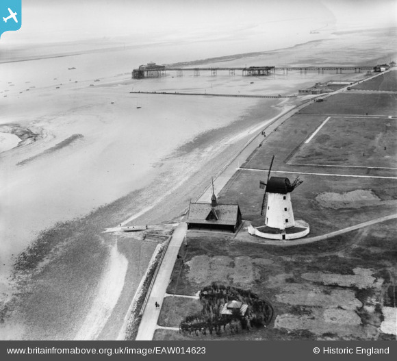
EAW014623 ENGLAND (1948). Lytham Windmill and Lifeboat House with the pier in the distance, Lytham, from the north-east, 1948
© Copyright OpenStreetMap contributors and licensed by the OpenStreetMap Foundation. 2026. Cartography is licensed as CC BY-SA.
Nearby Images (3)
EAW014623

EAW014624

EPW038759

Details
| Title | [EAW014623] Lytham Windmill and Lifeboat House with the pier in the distance, Lytham, from the north-east, 1948 |
| Reference | EAW014623 |
| Date | 21-April-1948 |
| Link | |
| Place name | LYTHAM |
| Parish | |
| District | |
| Country | ENGLAND |
| Easting / Northing | 337080, 426995 |
| Longitude / Latitude | -2.9539494853007, 53.735321160638 |
| National Grid Reference | SD371270 |
Pins
Be the first to add a comment to this image!