
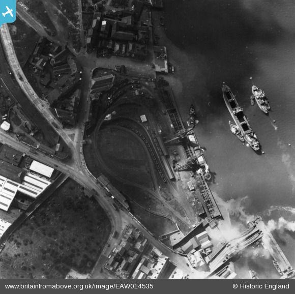
EAW014535 ENGLAND (1948). Harton Low Staithes, South Shields, 1948. This image has been produced from a print.
© Copyright OpenStreetMap contributors and licensed by the OpenStreetMap Foundation. 2026. Cartography is licensed as CC BY-SA.
Nearby Images (5)
EAW014535

EAW014537
, South Shields, 1948. This image has been produced from a damaged negative.")
EPW019783

EAW014530
, South Shields, 1948. This image has been produced from a damaged negative.")
EAW008935

Details
| Title | [EAW014535] Harton Low Staithes, South Shields, 1948. This image has been produced from a print. |
| Reference | EAW014535 |
| Date | 15-April-1948 |
| Link | |
| Place name | SOUTH SHIELDS |
| Parish | |
| District | |
| Country | ENGLAND |
| Easting / Northing | 435923, 566975 |
| Longitude / Latitude | -1.4384257140112, 54.99598434903 |
| National Grid Reference | NZ359670 |
