© Copyright OpenStreetMap contributors and licensed by the OpenStreetMap Foundation. 2025. Cartography is licensed as CC BY-SA.
Details
| Title |
[EAW014526] Dacre Castle, Dacre, 1948 |
| Reference |
EAW014526 |
| Date |
14-April-1948 |
| Link |
|
| Place name |
DACRE |
| Parish |
DACRE |
| District |
|
| Country |
ENGLAND |
| Easting / Northing |
346043, 526495 |
| Longitude / Latitude |
-2.8359216460301, 54.63058181726 |
| National Grid Reference |
NY460265 |
Pins
 DACRE CASTLE Dacre, Cumbria CA11 0HL
Grade 1 listed property - English Heritage Building ID: 73750
Fortified tower house. C14 with C17 and C19 alterations.
This 20 metre tall moated pele tower has 2 metre thick walls.
The 5th Lord Dacre had the castle converted into a more comfortable family home during the 1670’s, as law and order was gradually introduced to this previously troubled border region.
Renovated again in the 1960’s, the castle is now a comfortable private residence
The stone building replaced (about 1339-1354) a wooden tower at Dunmallet (or Dunmallogt) which had been built about 1307.
Also Scheduled Ancient Monument "Moated Site of Dacre Castle"- List entry Number: 1011680
The moated site at Dacre Castle survives reasonably well, its earthworks in particular remaining well preserved.
The monument includes the outer banks, moat and moated island upon which Dacre Castle stands.
(Dacre Castle, its cellars, a garage, a telegraph pole, all field and garden walls, fences and gateposts and the surfaces of all paths are excluded from the Ancient Monument scheduling but the ground beneath all these features is included.) |

totoro |
Saturday 15th of March 2014 01:02:43 PM |
User Comment Contributions
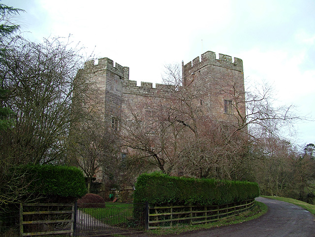
2007 - Dacre Castle.
The copyright on this image is owned by Geoff Gill and is licensed for reuse under the Creative Commons- Attribution- ShareAlike 2.0 license.
From http://en.wikibooks.org/wiki/Castles_of_England/Print_Version |

totoro |
Saturday 15th of March 2014 01:05:42 PM |


![[EAW014526] Dacre Castle, Dacre, 1948](http://britainfromabove.org.uk/sites/all/libraries/aerofilms-images/public/100x100/EAW/014/EAW014526.jpg)
![[EAW014524] St Andrew's Church, Dacre Castle and the village, Dacre, 1948](http://britainfromabove.org.uk/sites/all/libraries/aerofilms-images/public/100x100/EAW/014/EAW014524.jpg)
![[EAW014525] Dacre Castle and St Andrew's Church, Dacre, 1948](http://britainfromabove.org.uk/sites/all/libraries/aerofilms-images/public/100x100/EAW/014/EAW014525.jpg)