
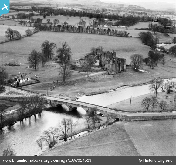
EAW014523 ENGLAND (1948). Brougham Castle and Brougham Castle Bridge, Brougham, 1948
© Copyright OpenStreetMap contributors and licensed by the OpenStreetMap Foundation. 2026. Cartography is licensed as CC BY-SA.
Nearby Images (8)
EAW014523

EAW009279

EAW014522

EAW009280

EAW009281

EAW009278

EAW009277

EAW009276

Details
| Title | [EAW014523] Brougham Castle and Brougham Castle Bridge, Brougham, 1948 |
| Reference | EAW014523 |
| Date | 14-April-1948 |
| Link | |
| Place name | BROUGHAM |
| Parish | BROUGHAM |
| District | |
| Country | ENGLAND |
| Easting / Northing | 353770, 529037 |
| Longitude / Latitude | -2.7166250880891, 54.654193935978 |
| National Grid Reference | NY538290 |
Pins

Matt Aldred edob.mattaldred.com |
Monday 15th of September 2025 04:19:21 PM |