
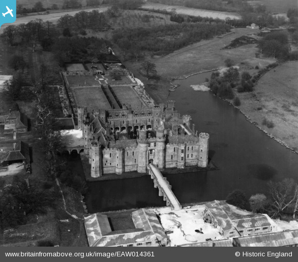
EAW014361 ENGLAND (1948). Herstmonceux Castle, Herstmonceux, 1948. This image has been produced from a print.
© Copyright OpenStreetMap contributors and licensed by the OpenStreetMap Foundation. 2026. Cartography is licensed as CC BY-SA.
Nearby Images (7)
EAW014361

EAW001454

EAW014360

EAW014362

EAW014359

EAW001453

EAW001455

Details
| Title | [EAW014361] Herstmonceux Castle, Herstmonceux, 1948. This image has been produced from a print. |
| Reference | EAW014361 |
| Date | 13-April-1948 |
| Link | |
| Place name | HERSTMONCEUX |
| Parish | HERSTMONCEUX |
| District | |
| Country | ENGLAND |
| Easting / Northing | 564673, 110409 |
| Longitude / Latitude | 0.34056513415222, 50.869139319397 |
| National Grid Reference | TQ647104 |
Pins
Be the first to add a comment to this image!