
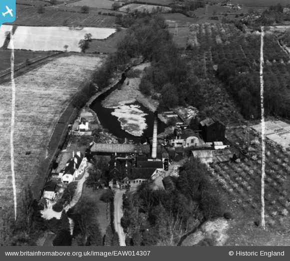
EAW014307 ENGLAND (1948). Roughway Paper Mills, Roughway, 1948. This image has been produced from a print marked by Aerofilms Ltd for photo editing.
© Copyright OpenStreetMap contributors and licensed by the OpenStreetMap Foundation. 2026. Cartography is licensed as CC BY-SA.
Nearby Images (8)
EAW014307

EAW014310

EAW014311

EAW014305

EAW014304

EAW014309

EAW014306

EAW014308

Details
| Title | [EAW014307] Roughway Paper Mills, Roughway, 1948. This image has been produced from a print marked by Aerofilms Ltd for photo editing. |
| Reference | EAW014307 |
| Date | 13-April-1948 |
| Link | |
| Place name | ROUGHWAY |
| Parish | PLAXTOL |
| District | |
| Country | ENGLAND |
| Easting / Northing | 561493, 152888 |
| Longitude / Latitude | 0.31436935804878, 51.251748628799 |
| National Grid Reference | TQ615529 |
Pins
Be the first to add a comment to this image!