
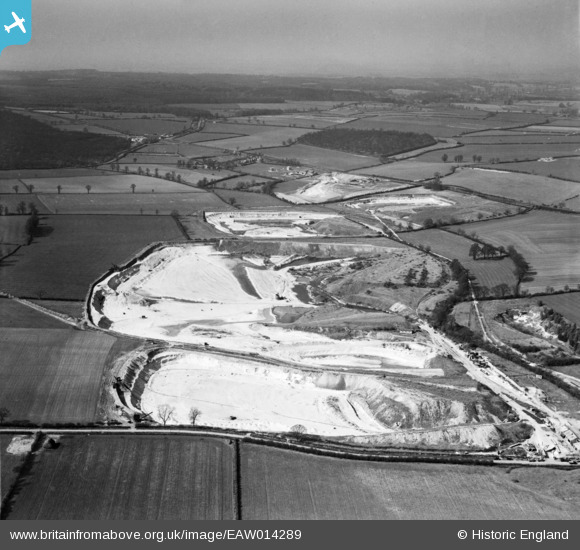
EAW014289 ENGLAND (1948). Chalk excavations to the east of the village, Heath and Reach, from the south, 1948
© Copyright OpenStreetMap contributors and licensed by the OpenStreetMap Foundation. 2026. Cartography is licensed as CC BY-SA.
Nearby Images (2)
EAW014289

EAW014293

Details
| Title | [EAW014289] Chalk excavations to the east of the village, Heath and Reach, from the south, 1948 |
| Reference | EAW014289 |
| Date | 12-April-1948 |
| Link | |
| Place name | HEATH AND REACH |
| Parish | HEATH AND REACH |
| District | |
| Country | ENGLAND |
| Easting / Northing | 494053, 228563 |
| Longitude / Latitude | -0.63142209087843, 51.947170343264 |
| National Grid Reference | SP941286 |
Pins

Tanllan |
Wednesday 15th of July 2020 12:51:25 PM | |
|
John W |
Wednesday 22nd of February 2017 07:44:31 PM | |
|
John W |
Wednesday 22nd of February 2017 07:42:43 PM | |
|
Joe90 |
Saturday 11th of January 2014 05:24:40 PM |