
EAW014288 ENGLAND (1948) [Unlocated]. UNLOCATED
© Copyright OpenStreetMap contributors and licensed by the OpenStreetMap Foundation. 2026. Cartography is licensed as CC BY-SA.
Nearby Images (48)
EPW000143

EPW000667

EPW005260

EPW006389
, 1921")
EPW007181

EPW015853

EPW015854

EPW015855

EPW016012

EPW016510

EPW016641

EPW017028

EPW017029

EPW017136

SAW003585

SAW003586

SAW009337

SAW009800

SAW009801

SAW009802

SAW010734

SAW014737

SAW017926

SAW017927

SAW032504

SPW020275

SPW020280

SPW020281

SPW020284

SPW020632

SPW020633

SPW027083

SPW049776

SPW049777

SPW049779

SPW049783

SPW049791

SPW049798

SPW049801

SPW049827

SPW049828

SPW049831

SPW049832

SPW049834

SPW049948

SPW049949

SPW051009

SPW062638

Details
| Title | [EAW014288] UNLOCATED |
| Reference | EAW014288 |
| Date | 12-April-1948 |
| Link | |
| Place name | |
| Parish | |
| District | |
| Country | ENGLAND |
| Easting / Northing | 0, 0 |
| Longitude / Latitude | -7.556448482059, 49.766185796754 |
| National Grid Reference | SV000000 |
Pins

Dylan Moore |
Tuesday 24th of December 2013 06:42:23 PM |
User Comment Contributions
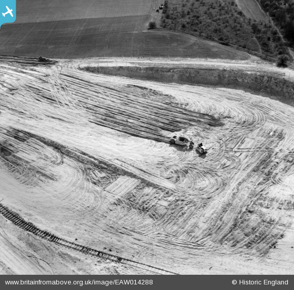
I am going to suggest that this photo is of the sand quarry to the north west of the Stonehenge Brick Works at Heath and Reach. I have put the pin in just above Sandpit Cottage. I am not entirely convinced of the orientation of the photo but I think we can safely say that the temporary track is of 2foot gauge some of which is shown on the 1952 6inch Ordnance Survey map of the area. |

Class31 |
Tuesday 11th of November 2014 12:45:10 PM |
This is only a suggestion and is entered to further the discussion. |
Class31 |
Tuesday 11th of November 2014 12:45:10 PM |
There is a piece of temporary standard gauge railway track in this photo which tends to suggest it is not one of the set of photos from the Smalley area of Derbyshire. So far we have not seen any railway track in the Smalley opencast site. |
Class31 |
Tuesday 11th of November 2014 12:20:55 PM |
I might be wrong about the gauge of the temporary track! |
Class31 |
Tuesday 11th of November 2014 12:20:55 PM |
EAW014287 is of Watling Street (A5) and the surrounding countryside, Heath and Reach, from the south-east, 1948 on the same date 12th April 1948 |
Class31 |
Tuesday 11th of November 2014 12:08:10 PM |
EAW014289 is of Chalk excavations to the east of the village, Heath and Reach, from the south, 1948 taken 12th April 1948 |
Class31 |
Tuesday 11th of November 2014 12:06:36 PM |