
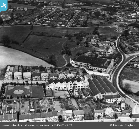
EAW014262 ENGLAND (1948). The Co-operative Wholesale Society Corset Factory, Desborough, 1948. This image has been produced from a print.
© Copyright OpenStreetMap contributors and licensed by the OpenStreetMap Foundation. 2026. Cartography is licensed as CC BY-SA.
Nearby Images (6)
EAW014262

EAW014260

EAW014261

EAW014259

EAW014258

EAW014257

Details
| Title | [EAW014262] The Co-operative Wholesale Society Corset Factory, Desborough, 1948. This image has been produced from a print. |
| Reference | EAW014262 |
| Date | 12-April-1948 |
| Link | |
| Place name | DESBOROUGH |
| Parish | DESBOROUGH |
| District | |
| Country | ENGLAND |
| Easting / Northing | 480035, 282973 |
| Longitude / Latitude | -0.82249538728274, 52.438486587846 |
| National Grid Reference | SP800830 |
Pins

John Wass |
Tuesday 10th of February 2015 03:58:56 PM | |
|
EastMarple1 |
Friday 26th of September 2014 11:24:36 PM |