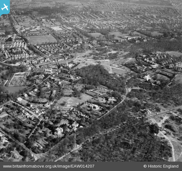
EAW014207 ENGLAND (1948). Roehampton Lane, Putney Heath and environs, Roehampton, 1948
© Copyright OpenStreetMap contributors and licensed by the OpenStreetMap Foundation. 2026. Cartography is licensed as CC BY-SA.
Nearby Images (2)
EAW014207

EAW014206

Details
| Title | [EAW014207] Roehampton Lane, Putney Heath and environs, Roehampton, 1948 |
| Reference | EAW014207 |
| Date | 7-April-1948 |
| Link | |
| Place name | ROEHAMPTON |
| Parish | |
| District | |
| Country | ENGLAND |
| Easting / Northing | 522660, 173538 |
| Longitude / Latitude | -0.23470274813585, 51.447038894519 |
| National Grid Reference | TQ227735 |
Pins

Dom |
Tuesday 12th of May 2020 05:00:04 PM | |
|
ThommoSW15 |
Friday 22nd of June 2018 03:29:59 PM | |
|
ThommoSW15 |
Friday 22nd of June 2018 03:26:15 PM | |
|
ThommoSW15 |
Friday 22nd of June 2018 03:25:28 PM | |
|
ThommoSW15 |
Friday 22nd of June 2018 03:24:44 PM | |
|
ThommoSW15 |
Friday 22nd of June 2018 03:22:16 PM | |
|
ThommoSW15 |
Friday 22nd of June 2018 03:21:25 PM | |
|
ThommoSW15 |
Friday 22nd of June 2018 03:20:20 PM | |

Class31 |
Wednesday 9th of September 2015 02:59:05 PM | |
|
Class31 |
Wednesday 9th of September 2015 02:57:48 PM | |
|
Class31 |
Wednesday 9th of September 2015 02:44:40 PM |