
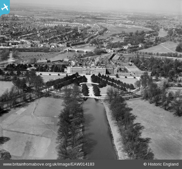
EAW014183 ENGLAND (1948). Hampton Court Palace and environs, Hampton Court Park, from the east, 1948
© Copyright OpenStreetMap contributors and licensed by the OpenStreetMap Foundation. 2026. Cartography is licensed as CC BY-SA.
Nearby Images (3)
EAW014183

EAW014146

EAW014147

Details
| Title | [EAW014183] Hampton Court Palace and environs, Hampton Court Park, from the east, 1948 |
| Reference | EAW014183 |
| Date | 7-April-1948 |
| Link | |
| Place name | HAMPTON COURT PARK |
| Parish | |
| District | |
| Country | ENGLAND |
| Easting / Northing | 516239, 168380 |
| Longitude / Latitude | -0.32876148041918, 51.402029390403 |
| National Grid Reference | TQ162684 |
Pins

Alan McFaden |
Sunday 19th of January 2014 09:42:42 PM | |
|
Alan McFaden |
Sunday 19th of January 2014 09:42:01 PM | |
|
Alan McFaden |
Sunday 19th of January 2014 09:41:25 PM | |

Pip |
Saturday 11th of January 2014 11:48:54 AM | |
|
Pip |
Saturday 11th of January 2014 11:48:27 AM | |
|
Pip |
Saturday 11th of January 2014 11:47:46 AM | |
|
Pip |
Saturday 11th of January 2014 11:46:42 AM | |
|
Pip |
Saturday 11th of January 2014 11:45:59 AM | |
|
Pip |
Saturday 11th of January 2014 11:44:58 AM | |
|
Pip |
Saturday 11th of January 2014 11:43:59 AM | |
|
Pip |
Saturday 11th of January 2014 11:39:16 AM | |
|
Pip |
Saturday 11th of January 2014 11:36:46 AM |


