
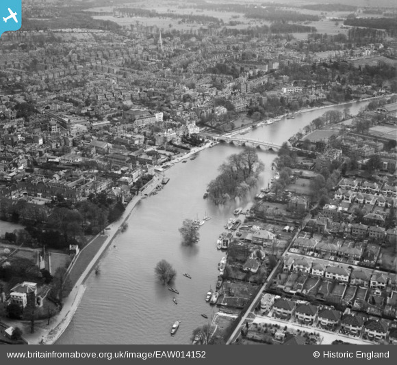
EAW014152 ENGLAND (1948). Richmond Bridge, Corporation Island and the town, Richmond, from the north-west, 1948
© Copyright OpenStreetMap contributors and licensed by the OpenStreetMap Foundation. 2026. Cartography is licensed as CC BY-SA.
Nearby Images (12)
EAW014152

EPW031987

EPW031988

EPW031990

EPW031992

EPW022840

EPW031989

EPW031991

EAW014151

EAW014150

EAW014149

EAW008241

Details
| Title | [EAW014152] Richmond Bridge, Corporation Island and the town, Richmond, from the north-west, 1948 |
| Reference | EAW014152 |
| Date | 7-April-1948 |
| Link | |
| Place name | RICHMOND |
| Parish | |
| District | |
| Country | ENGLAND |
| Easting / Northing | 517427, 174698 |
| Longitude / Latitude | -0.3095938376027, 51.458575258244 |
| National Grid Reference | TQ174747 |
Pins

richmondboy |
Saturday 7th of July 2018 10:58:26 AM | |
|
richmondboy |
Saturday 7th of July 2018 10:57:04 AM | |
|
Wordy |
Sunday 4th of May 2014 03:29:10 PM | |
|
Wordy |
Sunday 4th of May 2014 03:28:03 PM | |
|
Wordy |
Sunday 4th of May 2014 03:26:31 PM | |
|
Wordy |
Sunday 4th of May 2014 03:24:50 PM |