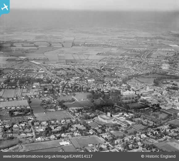
EAW014117 ENGLAND (1948). University Library and the city, Cambridge, from the south-west, 1948
© Copyright OpenStreetMap contributors and licensed by the OpenStreetMap Foundation. 2026. Cartography is licensed as CC BY-SA.
Nearby Images (11)
Details
| Title | [EAW014117] University Library and the city, Cambridge, from the south-west, 1948 |
| Reference | EAW014117 |
| Date | 25-March-1948 |
| Link | |
| Place name | CAMBRIDGE |
| Parish | |
| District | |
| Country | ENGLAND |
| Easting / Northing | 544053, 258488 |
| Longitude / Latitude | 0.10833244483696, 52.205363153959 |
| National Grid Reference | TL441585 |
Pins

Matt Aldred edob.mattaldred.com |
Sunday 10th of March 2024 06:48:57 PM | |

Matt Aldred edob.mattaldred.com |
Sunday 10th of March 2024 06:48:44 PM | |

Matt Aldred edob.mattaldred.com |
Thursday 7th of March 2024 10:07:43 AM | |

Matt Aldred edob.mattaldred.com |
Friday 10th of April 2020 09:30:03 PM |


![[EAW014117] University Library and the city, Cambridge, from the south-west, 1948](http://britainfromabove.org.uk/sites/all/libraries/aerofilms-images/public/100x100/EAW/014/EAW014117.jpg)
![[EAW002926] University Library, Cambridge, 1946](http://britainfromabove.org.uk/sites/all/libraries/aerofilms-images/public/100x100/EAW/002/EAW002926.jpg)
![[EPW045037] University Library, Memorial Court and St John's College Playing Fields, Cambridge, 1934](http://britainfromabove.org.uk/sites/all/libraries/aerofilms-images/public/100x100/EPW/045/EPW045037.jpg)
![[EAW011271] The University Library and Clare College Memorial Court, Cambridge, 1947](http://britainfromabove.org.uk/sites/all/libraries/aerofilms-images/public/100x100/EAW/011/EAW011271.jpg)
![[EAW002927] University Library, Cambridge, 1946](http://britainfromabove.org.uk/sites/all/libraries/aerofilms-images/public/100x100/EAW/002/EAW002927.jpg)
![[EAW011272] The University Library and Clare College Memorial Court, Cambridge, 1947](http://britainfromabove.org.uk/sites/all/libraries/aerofilms-images/public/100x100/EAW/011/EAW011272.jpg)
![[EPW059035] University Library and Memorial Court, Cambridge, 1938](http://britainfromabove.org.uk/sites/all/libraries/aerofilms-images/public/100x100/EPW/059/EPW059035.jpg)
![[EPW045035] University Library, Memorial Court and St John's College Playing Fields, Cambridge, 1934](http://britainfromabove.org.uk/sites/all/libraries/aerofilms-images/public/100x100/EPW/045/EPW045035.jpg)
![[EPW045034] University Library and Memorial Court, Cambridge, 1934](http://britainfromabove.org.uk/sites/all/libraries/aerofilms-images/public/100x100/EPW/045/EPW045034.jpg)
![[EPW045036] University Library and the University Rugby Ground, Cambridge, 1934](http://britainfromabove.org.uk/sites/all/libraries/aerofilms-images/public/100x100/EPW/045/EPW045036.jpg)
![[EPW000040] Grange Road, Cambridge, 1920](http://britainfromabove.org.uk/sites/all/libraries/aerofilms-images/public/100x100/EPW/000/EPW000040.jpg)