
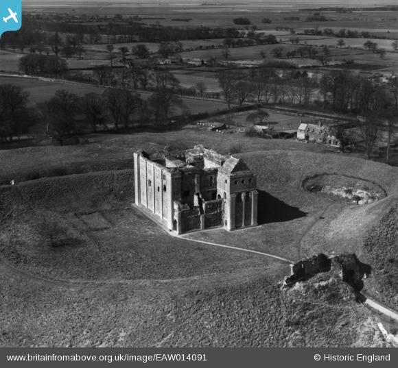
EAW014091 ENGLAND (1948). The Castle, Castle Rising, 1948. This image has been produced from a print.
© Copyright OpenStreetMap contributors and licensed by the OpenStreetMap Foundation. 2026. Cartography is licensed as CC BY-SA.
Nearby Images (13)
EAW014091

EAW014092

EPW021563

EAW014088

EAW005082

EAW005083

EAW005084

EPW021556

EAW014089

EAW014090

EAW005081

EPW021561

EPW021562

Details
| Title | [EAW014091] The Castle, Castle Rising, 1948. This image has been produced from a print. |
| Reference | EAW014091 |
| Date | 25-March-1948 |
| Link | |
| Place name | CASTLE RISING |
| Parish | CASTLE RISING |
| District | |
| Country | ENGLAND |
| Easting / Northing | 566581, 324556 |
| Longitude / Latitude | 0.47080965213172, 52.792485950492 |
| National Grid Reference | TF666246 |
Pins
Be the first to add a comment to this image!