
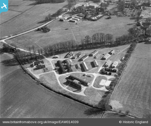
EAW014039 ENGLAND (1948). An unidentified military site just to the north of Manor Farm, Graveley, 1948
© Copyright OpenStreetMap contributors and licensed by the OpenStreetMap Foundation. 2026. Cartography is licensed as CC BY-SA.
Details
| Title | [EAW014039] An unidentified military site just to the north of Manor Farm, Graveley, 1948 |
| Reference | EAW014039 |
| Date | 23-March-1948 |
| Link | |
| Place name | GRAVELEY |
| Parish | GRAVELEY |
| District | |
| Country | ENGLAND |
| Easting / Northing | 525097, 264268 |
| Longitude / Latitude | -0.1667993993719, 52.261936139161 |
| National Grid Reference | TL251643 |
Pins

Matt Aldred edob.mattaldred.com |
Monday 21st of March 2022 03:32:33 PM | |
|
Matt Aldred edob.mattaldred.com |
Monday 21st of March 2022 03:32:21 PM | |
|
Matt Aldred edob.mattaldred.com |
Monday 21st of March 2022 03:31:37 PM | |
|
Matt Aldred edob.mattaldred.com |
Monday 21st of March 2022 03:31:25 PM | |
|
Matt Aldred edob.mattaldred.com |
Monday 21st of March 2022 03:31:12 PM | |
|
Matt Aldred edob.mattaldred.com |
Monday 21st of March 2022 03:30:47 PM | |
|
Matt Aldred edob.mattaldred.com |
Monday 21st of March 2022 03:27:11 PM | |

Mike Holder |
Tuesday 16th of February 2016 09:33:53 AM | |
|
Mike Holder |
Tuesday 16th of February 2016 09:30:49 AM | |
|
Mike Holder |
Sunday 14th of February 2016 10:00:44 PM | |
|
Mike Holder |
Sunday 14th of February 2016 09:55:36 PM | |
|
Mike Holder |
Sunday 14th of February 2016 09:54:06 PM | |
|
Mike Holder |
Sunday 14th of February 2016 09:44:52 PM | |
|
Mike Holder |
Sunday 14th of February 2016 09:40:20 PM | |
|
cptpies |
Tuesday 20th of January 2015 11:05:18 AM | |
|
cptpies |
Tuesday 20th of January 2015 11:05:06 AM | |
|
cptpies |
Tuesday 20th of January 2015 11:04:51 AM | |
|
cptpies |
Tuesday 20th of January 2015 11:04:38 AM | |
|
cptpies |
Tuesday 20th of January 2015 11:04:14 AM |
User Comment Contributions

Various shelters at a dispersed site, RAF Graveley. |
cptpies |
Tuesday 20th of January 2015 11:06:33 AM |
Part of RAF Graveley, lies east of the airfield. Accommodation and possibly Station Sick Quarters or Admin. |

clippedwings |
Friday 17th of January 2014 08:11:44 PM |