
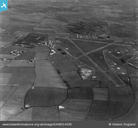
EAW014035 ENGLAND (1948). RAF Graveley, Offord D'Arcy, 1948. This image has been produced from a print.
© Copyright OpenStreetMap contributors and licensed by the OpenStreetMap Foundation. 2026. Cartography is licensed as CC BY-SA.
Nearby Images (2)
EAW014035

EAW014037

Details
| Title | [EAW014035] RAF Graveley, Offord D'Arcy, 1948. This image has been produced from a print. |
| Reference | EAW014035 |
| Date | 23-March-1948 |
| Link | |
| Place name | OFFORD D'ARCY |
| Parish | OFFORD CLUNY AND OFFORD D'ARCY |
| District | |
| Country | ENGLAND |
| Easting / Northing | 523205, 264576 |
| Longitude / Latitude | -0.19439770566726, 52.265131207626 |
| National Grid Reference | TL232646 |
Pins

Paul Bass |
Wednesday 27th of November 2024 10:51:43 AM |