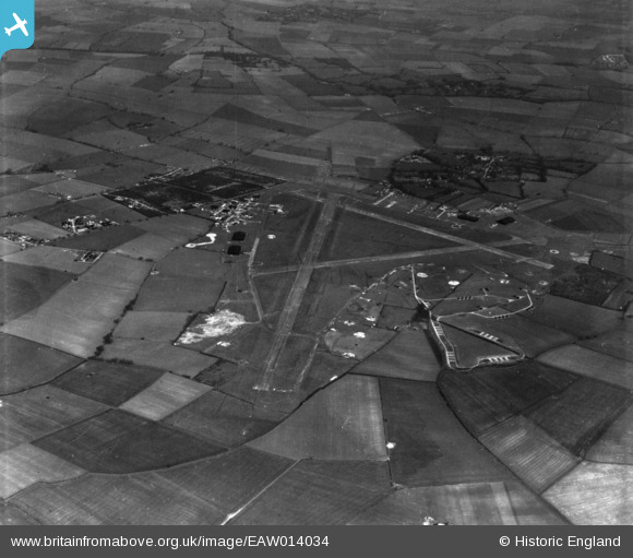
EAW014034 ENGLAND (1948). RAF Graveley, Offord D'Arcy, 1948. This image has been produced from a print.
© Copyright OpenStreetMap contributors and licensed by the OpenStreetMap Foundation. 2026. Cartography is licensed as CC BY-SA.
Nearby Images (5)
Details
| Title | [EAW014034] RAF Graveley, Offord D'Arcy, 1948. This image has been produced from a print. |
| Reference | EAW014034 |
| Date | 23-March-1948 |
| Link | |
| Place name | OFFORD D'ARCY |
| Parish | OFFORD CLUNY AND OFFORD D'ARCY |
| District | |
| Country | ENGLAND |
| Easting / Northing | 523556, 264250 |
| Longitude / Latitude | -0.18937586236452, 52.262122742749 |
| National Grid Reference | TL236643 |
Pins
Be the first to add a comment to this image!


![[EAW014034] RAF Graveley, Offord D'Arcy, 1948. This image has been produced from a print.](http://britainfromabove.org.uk/sites/all/libraries/aerofilms-images/public/100x100/EAW/014/EAW014034.jpg)
![[EAW014033] RAF Graveley, Offord D'Arcy, 1948. This image has been produced from a print.](http://britainfromabove.org.uk/sites/all/libraries/aerofilms-images/public/100x100/EAW/014/EAW014033.jpg)
![[EAW014036] RAF Graveley, Offord D'Arcy, 1948. This image has been produced from a print.](http://britainfromabove.org.uk/sites/all/libraries/aerofilms-images/public/100x100/EAW/014/EAW014036.jpg)
![[EAW014031] RAF Graveley, Offord D'Arcy, 1948. This image has been produced from a print.](http://britainfromabove.org.uk/sites/all/libraries/aerofilms-images/public/100x100/EAW/014/EAW014031.jpg)
![[EAW014038] RAF Graveley, Offord D'Arcy, 1948](http://britainfromabove.org.uk/sites/all/libraries/aerofilms-images/public/100x100/EAW/014/EAW014038.jpg)