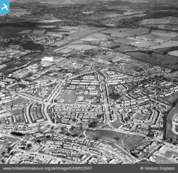
EAW013997 ENGLAND (1948). Peartree, Welwyn Garden City, 1948
    © Copyright OpenStreetMap contributors and licensed by the OpenStreetMap Foundation. 2025. Cartography is licensed as CC BY-SA.
  
Nearby Images (5)
Details
| Title | [EAW013997] Peartree, Welwyn Garden City, 1948 | 
| Reference | EAW013997 | 
| Date | 23-March-1948 | 
| Link | |
| Place name | WELWYN GARDEN CITY | 
| Parish | |
| District | |
| Country | ENGLAND | 
| Easting / Northing | 524566, 212450 | 
| Longitude / Latitude | -0.19344714275745, 51.796359197046 | 
| National Grid Reference | TL246125 | 
Pins
|  PILLBOX: S0005037 |   Matt Aldred edob.mattaldred.com | Monday 12th of July 2021 07:27:51 PM | 
|  The Pear Tree pub (built 1938-40) |   Emily Cole | Wednesday 5th of November 2014 01:33:31 PM | 
 
             
  ![[EAW013997] Peartree, Welwyn Garden City, 1948](http://britainfromabove.org.uk/sites/all/libraries/aerofilms-images/public/100x100/EAW/013/EAW013997.jpg) 
  
                                          ![[EPW054499] The residential area at Peartree, Welwyn Garden City, 1937](http://britainfromabove.org.uk/sites/all/libraries/aerofilms-images/public/100x100/EPW/054/EPW054499.jpg) 
 ![[EPW054522] The residential and industrial area at Peartree, Welwyn Garden City, 1937](http://britainfromabove.org.uk/sites/all/libraries/aerofilms-images/public/100x100/EPW/054/EPW054522.jpg) 
 ![[EPW054541] The residential area surrounding Verulam Close, Cranborne Gardens and Shortlands Green, Peartree, 1937](http://britainfromabove.org.uk/sites/all/libraries/aerofilms-images/public/100x100/EPW/054/EPW054541.jpg) 
 ![[EPW054520] The residential and industrial area at Peartree, Welwyn Garden City, 1937](http://britainfromabove.org.uk/sites/all/libraries/aerofilms-images/public/100x100/EPW/054/EPW054520.jpg)