
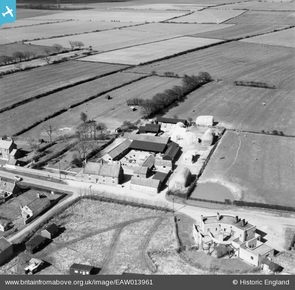
EAW013961 ENGLAND (1948). Manor Farm and the Black Bull Public House, Barmston, 1948
© Copyright OpenStreetMap contributors and licensed by the OpenStreetMap Foundation. 2025. Cartography is licensed as CC BY-SA.
Nearby Images (3)
EAW013961

EAW013963

EAW013962

Details
| Title | [EAW013961] Manor Farm and the Black Bull Public House, Barmston, 1948 |
| Reference | EAW013961 |
| Date | 23-March-1948 |
| Link | |
| Place name | BARMSTON |
| Parish | BARMSTON |
| District | |
| Country | ENGLAND |
| Easting / Northing | 516241, 459155 |
| Longitude / Latitude | -0.22576839167987, 54.015108027252 |
| National Grid Reference | TA162592 |
Pins
Be the first to add a comment to this image!