
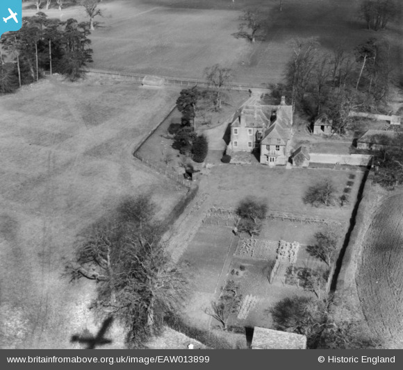
EAW013899 ENGLAND (1948). Kippen House, Frinsted, 1948. This image has been produced from a print.
© Copyright OpenStreetMap contributors and licensed by the OpenStreetMap Foundation. 2026. Cartography is licensed as CC BY-SA.
Nearby Images (12)
EAW013899

EAW013907

EAW013898

EAW013900

EAW013901

EAW013904

EAW013897

EAW013902

EAW013903

EAW013905

EAW013906

EAW013896

Details
| Title | [EAW013899] Kippen House, Frinsted, 1948. This image has been produced from a print. |
| Reference | EAW013899 |
| Date | 18-March-1948 |
| Link | |
| Place name | FRINSTED |
| Parish | FRINSTED |
| District | |
| Country | ENGLAND |
| Easting / Northing | 589886, 157174 |
| Longitude / Latitude | 0.72309202676112, 51.281501719383 |
| National Grid Reference | TQ899572 |
Pins
Be the first to add a comment to this image!