
Downtime message
Due to planned maintenance taking place on Thursday 9th October between 9:00 AM and 1:00 PM, services might be disrupted or temporarily unavailable. We apologise for any inconvenience.
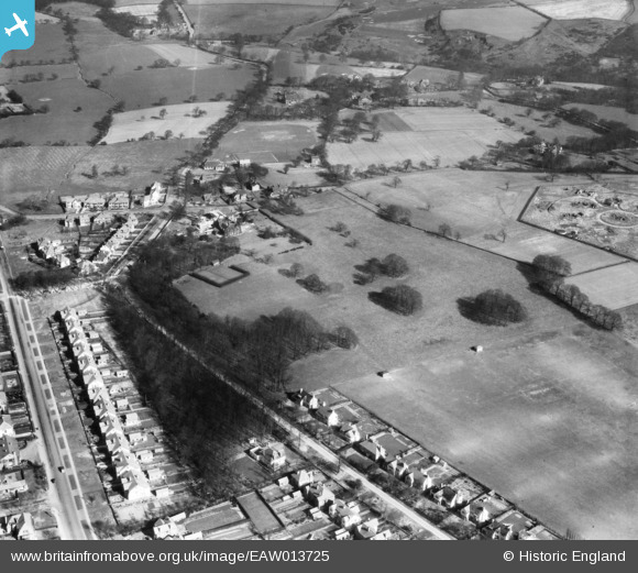
EAW013725 ENGLAND (1948). Sadler Hall (University Hall of Residence) and the surrounding area, Adel, 1948
© Copyright OpenStreetMap contributors and licensed by the OpenStreetMap Foundation. 2025. Cartography is licensed as CC BY-SA.
Nearby Images (5)
EAW013725
 and the surrounding area, Adel, 1948")
EAW013724
 and the surrounding area, Adel, 1948")
EAW013726
, Church Lane and the surrounding area, Adel, 1948")
EAW013727
 and the surrounding area, Adel, 1948")
EAW013728
 and the surrounding area, Adel, 1948")
Details
| Title | [EAW013725] Sadler Hall (University Hall of Residence) and the surrounding area, Adel, 1948 |
| Reference | EAW013725 |
| Date | 11-March-1948 |
| Link | |
| Place name | ADEL |
| Parish | |
| District | |
| Country | ENGLAND |
| Easting / Northing | 427221, 439775 |
| Longitude / Latitude | -1.5861390443455, 53.853283698714 |
| National Grid Reference | SE272398 |
Pins

redmist |
Thursday 22nd of August 2024 06:17:52 PM |