
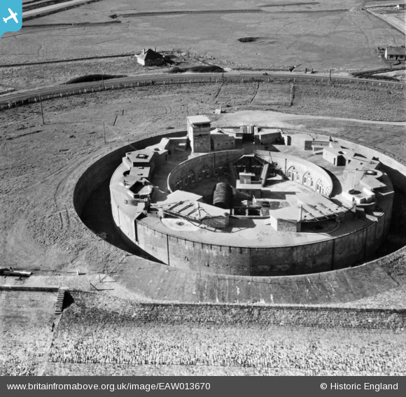
EAW013670 ENGLAND (1948). Dymchurch Redoubt, Hythe, 1948
© Copyright OpenStreetMap contributors and licensed by the OpenStreetMap Foundation. 2026. Cartography is licensed as CC BY-SA.
Nearby Images (2)
EAW013670

EAW008994

Details
| Title | [EAW013670] Dymchurch Redoubt, Hythe, 1948 |
| Reference | EAW013670 |
| Date | 10-March-1948 |
| Link | |
| Place name | DYMCHURCH |
| Parish | HYTHE |
| District | |
| Country | ENGLAND |
| Easting / Northing | 612916, 132117 |
| Longitude / Latitude | 1.0380516857573, 51.048340948615 |
| National Grid Reference | TR129321 |
Pins

rivermersey |
Monday 5th of October 2020 11:31:25 PM | |

Sparky |
Thursday 6th of July 2017 12:39:54 AM | |
|
Al |
Thursday 30th of January 2014 12:44:30 AM | |
|
Al |
Thursday 30th of January 2014 12:43:31 AM | |
|
Al |
Thursday 30th of January 2014 12:42:58 AM |
User Comment Contributions

EMERGENCY COAST ARTILLERY BATTERY: S0007362 |
Al |
Thursday 30th of January 2014 12:45:04 AM |