
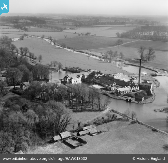
EAW013502 ENGLAND (1948). St Neots Paper Mills, Little Paxton, from the north-west, 1948
© Copyright OpenStreetMap contributors and licensed by the OpenStreetMap Foundation. 2026. Cartography is licensed as CC BY-SA.
Nearby Images (16)
EAW013502

EAW003730

EAW013506

EAW013507

EAW013499

EAW013508

EAW013497

EAW013503

EAW013500

EAW013510

EAW013498

EAW013511

EAW013501

EAW013504

EAW013509

EAW013505

Details
| Title | [EAW013502] St Neots Paper Mills, Little Paxton, from the north-west, 1948 |
| Reference | EAW013502 |
| Date | 9-March-1948 |
| Link | |
| Place name | LITTLE PAXTON |
| Parish | LITTLE PAXTON |
| District | |
| Country | ENGLAND |
| Easting / Northing | 518511, 261919 |
| Longitude / Latitude | -0.26408729840709, 52.242283850262 |
| National Grid Reference | TL185619 |
Pins

melgibbs |
Saturday 15th of February 2014 06:05:32 PM |