
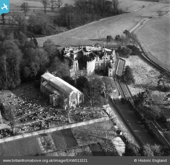
EAW013221 ENGLAND (1948). St Mary's Church and Berkeley Castle, Berkeley, 1948
© Copyright OpenStreetMap contributors and licensed by the OpenStreetMap Foundation. 2026. Cartography is licensed as CC BY-SA.
Nearby Images (13)
EAW013221

EAW006846

EAW006843

EAW006842

EAW013220

EAW006847

EPW024125

EAW006844

EAW006845

EAW013219

EPW024124

EPW024126

EPW024127

Details
| Title | [EAW013221] St Mary's Church and Berkeley Castle, Berkeley, 1948 |
| Reference | EAW013221 |
| Date | 12-February-1948 |
| Link | |
| Place name | BERKELEY |
| Parish | BERKELEY |
| District | |
| Country | ENGLAND |
| Easting / Northing | 368491, 199005 |
| Longitude / Latitude | -2.4558641224677, 51.688454124096 |
| National Grid Reference | ST685990 |
Pins
Be the first to add a comment to this image!
User Comment Contributions

Berkeley Castle, 09/08/2015 |

Class31 |
Monday 10th of August 2015 10:20:33 AM |