
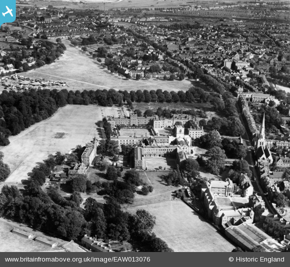
EAW013076 ENGLAND (1947). Jesus College, Cambridge, 1947
© Copyright OpenStreetMap contributors and licensed by the OpenStreetMap Foundation. 2026. Cartography is licensed as CC BY-SA.
Nearby Images (18)
EAW013076

EAW013078

EAW011259

EAW011263

EAW011258

EAW011262

EAW013079

EAW011266

EAW011265

EAW011257

EAW011264

EAW011267

EPW025471

EAW011256

EAW013077

EAW011268

EAW011261

EAW011260

Details
| Title | [EAW013076] Jesus College, Cambridge, 1947 |
| Reference | EAW013076 |
| Date | 6-September-1947 |
| Link | |
| Place name | CAMBRIDGE |
| Parish | |
| District | |
| Country | ENGLAND |
| Easting / Northing | 545306, 258909 |
| Longitude / Latitude | 0.12683817863714, 52.208816988273 |
| National Grid Reference | TL453589 |
Pins

Matt Aldred edob.mattaldred.com |
Sunday 8th of November 2020 09:16:08 PM | |
|
Matt Aldred edob.mattaldred.com |
Sunday 8th of November 2020 09:15:55 PM | |
|
Matt Aldred edob.mattaldred.com |
Sunday 8th of November 2020 09:15:14 PM |