
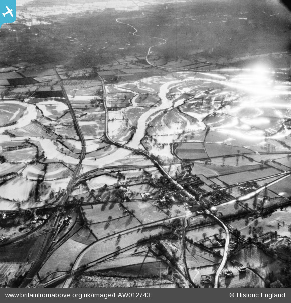
EAW012743 ENGLAND (1948). Road and rail crossings of a flooded River Vyrnwy, Llanymynech, from the north-west, 1948
© Copyright OpenStreetMap contributors and licensed by the OpenStreetMap Foundation. 2026. Cartography is licensed as CC BY-SA.
Details
| Title | [EAW012743] Road and rail crossings of a flooded River Vyrnwy, Llanymynech, from the north-west, 1948 |
| Reference | EAW012743 |
| Date | 14-January-1948 |
| Link | |
| Place name | LLANYMYNECH |
| Parish | LLANYMYNECH AND PANT |
| District | |
| Country | ENGLAND |
| Easting / Northing | 326865, 320830 |
| Longitude / Latitude | -3.0843842807666, 52.779758212273 |
| National Grid Reference | SJ269208 |
Pins

Andrew Bennett |
Wednesday 11th of June 2014 11:19:19 PM | |
|
Andrew Bennett |
Wednesday 11th of June 2014 11:14:52 PM | |
|
Andrew Bennett |
Wednesday 11th of June 2014 11:04:43 PM |
User Comment Contributions

Offas Dyke at Llanymynech. |
thetreehunter |
Saturday 3rd of January 2015 12:16:25 PM |