
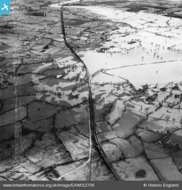
EAW012706 ENGLAND (1948). Extensive flooding around and to the south-west of the former Shropshire and Montgomeryshire Light Railway, Pentre, 1948
© Copyright OpenStreetMap contributors and licensed by the OpenStreetMap Foundation. 2025. Cartography is licensed as CC BY-SA.
Nearby Images (2)
EAW012706

EAW012704

Details
| Title | [EAW012706] Extensive flooding around and to the south-west of the former Shropshire and Montgomeryshire Light Railway, Pentre, 1948 |
| Reference | EAW012706 |
| Date | 14-January-1948 |
| Link | |
| Place name | PENTRE |
| Parish | KINNERLEY |
| District | |
| Country | ENGLAND |
| Easting / Northing | 336832, 317881 |
| Longitude / Latitude | -2.9360564652269, 52.754507008072 |
| National Grid Reference | SJ368179 |
Pins
Be the first to add a comment to this image!