
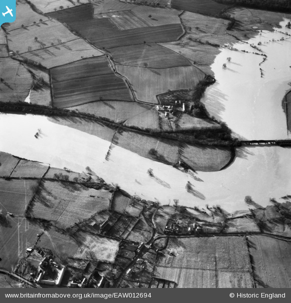
EAW012694 ENGLAND (1948). The River Severn in flood near Little Shrawardine Farm, Little Shrawardine, 1948
© Copyright OpenStreetMap contributors and licensed by the OpenStreetMap Foundation. 2026. Cartography is licensed as CC BY-SA.
Nearby Images (4)
EAW012694

EAW012841

EAW012696

EAW012695

Details
| Title | [EAW012694] The River Severn in flood near Little Shrawardine Farm, Little Shrawardine, 1948 |
| Reference | EAW012694 |
| Date | 14-January-1948 |
| Link | |
| Place name | LITTLE SHRAWARDINE |
| Parish | ALBERBURY WITH CARDESTON |
| District | |
| Country | ENGLAND |
| Easting / Northing | 339474, 315106 |
| Longitude / Latitude | -2.8963992368158, 52.729863571772 |
| National Grid Reference | SJ395151 |
Pins
Be the first to add a comment to this image!