
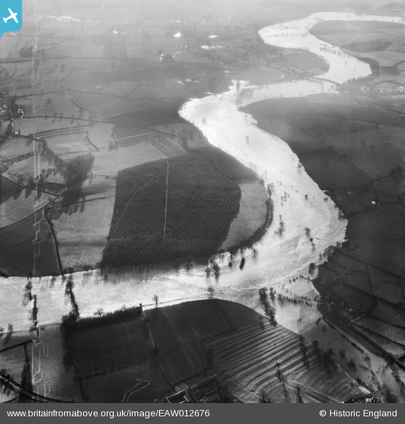
EAW012676 ENGLAND (1948). The River Severn in flood at Bickley Coppice, Bicton, 1948
© Copyright OpenStreetMap contributors and licensed by the OpenStreetMap Foundation. 2026. Cartography is licensed as CC BY-SA.
Nearby Images (4)
EAW012676

EAW012592

EAW012854

EAW012677

Details
| Title | [EAW012676] The River Severn in flood at Bickley Coppice, Bicton, 1948 |
| Reference | EAW012676 |
| Date | 14-January-1948 |
| Link | |
| Place name | BICTON |
| Parish | BICTON |
| District | |
| Country | ENGLAND |
| Easting / Northing | 344038, 316210 |
| Longitude / Latitude | -2.8290019913433, 52.740279772323 |
| National Grid Reference | SJ440162 |
Pins
Be the first to add a comment to this image!