
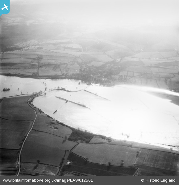
EAW012561 ENGLAND (1948). The River Severn in flood, Cressage, 1948
© Copyright OpenStreetMap contributors and licensed by the OpenStreetMap Foundation. 2026. Cartography is licensed as CC BY-SA.
Nearby Images (2)
EAW012561

EAW012655

Details
| Title | [EAW012561] The River Severn in flood, Cressage, 1948 |
| Reference | EAW012561 |
| Date | 14-January-1948 |
| Link | |
| Place name | CRESSAGE |
| Parish | CRESSAGE |
| District | |
| Country | ENGLAND |
| Easting / Northing | 359197, 304488 |
| Longitude / Latitude | -2.6030043439022, 52.636253651922 |
| National Grid Reference | SJ592045 |
Pins

Matt Aldred edob.mattaldred.com |
Sunday 30th of January 2022 09:40:59 PM | |
|
Matt Aldred edob.mattaldred.com |
Sunday 30th of January 2022 09:40:44 PM |