
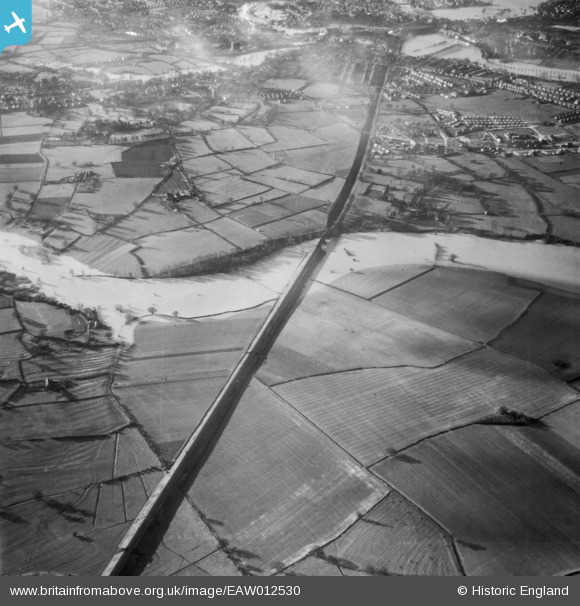
EAW012530 ENGLAND (1948). The River Severn in flood, Shrewsbury, 1948
© Copyright OpenStreetMap contributors and licensed by the OpenStreetMap Foundation. 2026. Cartography is licensed as CC BY-SA.
Nearby Images (3)
EAW012530

EAW012627

EAW017231

Details
| Title | [EAW012530] The River Severn in flood, Shrewsbury, 1948 |
| Reference | EAW012530 |
| Date | 14-January-1948 |
| Link | |
| Place name | SHREWSBURY |
| Parish | SHREWSBURY |
| District | |
| Country | ENGLAND |
| Easting / Northing | 351935, 312526 |
| Longitude / Latitude | -2.7114899294075, 52.707920730466 |
| National Grid Reference | SJ519125 |
Pins

Andrew Bennett |
Saturday 1st of March 2014 11:36:12 PM | |
|
Andrew Bennett |
Saturday 1st of March 2014 11:35:18 PM | |
|
Andrew Bennett |
Saturday 1st of March 2014 11:31:44 PM | |
|
Andrew Bennett |
Saturday 1st of March 2014 11:30:34 PM | |
|
Andrew Bennett |
Saturday 1st of March 2014 11:27:53 PM |