
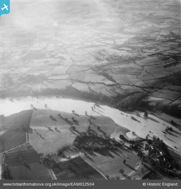
EAW012504 ENGLAND (1948). The River Severn in flood, Upper Berwick, from the north-east, 1948
© Copyright OpenStreetMap contributors and licensed by the OpenStreetMap Foundation. 2026. Cartography is licensed as CC BY-SA.
Nearby Images (4)
EAW012504

EAW012611

EAW012610

EAW012503

Details
| Title | [EAW012504] The River Severn in flood, Upper Berwick, from the north-east, 1948 |
| Reference | EAW012504 |
| Date | 14-January-1948 |
| Link | |
| Place name | UPPER BERWICK |
| Parish | PIMHILL |
| District | |
| Country | ENGLAND |
| Easting / Northing | 347051, 314471 |
| Longitude / Latitude | -2.7840925752862, 52.724950084574 |
| National Grid Reference | SJ471145 |
Pins
Be the first to add a comment to this image!