
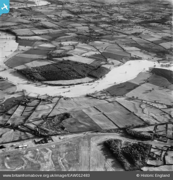
EAW012483 ENGLAND (1948). The River Severn in flood at Bickley Coppice, Bicton, 1948
© Copyright OpenStreetMap contributors and licensed by the OpenStreetMap Foundation. 2026. Cartography is licensed as CC BY-SA.
Nearby Images (4)
EAW012483

EAW012854

EAW012677

EAW012592

Details
| Title | [EAW012483] The River Severn in flood at Bickley Coppice, Bicton, 1948 |
| Reference | EAW012483 |
| Date | 14-January-1948 |
| Link | |
| Place name | BICTON |
| Parish | BICTON |
| District | |
| Country | ENGLAND |
| Easting / Northing | 343787, 316220 |
| Longitude / Latitude | -2.8327215063463, 52.740343624706 |
| National Grid Reference | SJ438162 |
Pins

Gerald |
Sunday 7th of June 2026 07:41:21 PM | |
|
Graham Yaxley |
Friday 30th of January 2015 10:48:41 PM |