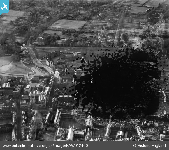
EAW012460 ENGLAND (1947). Silver Street and environs, Cambridge, 1947. This image has been produced from a damaged negative.
© Copyright OpenStreetMap contributors and licensed by the OpenStreetMap Foundation. 2026. Cartography is licensed as CC BY-SA.
Nearby Images (38)
Details
| Title | [EAW012460] Silver Street and environs, Cambridge, 1947. This image has been produced from a damaged negative. |
| Reference | EAW012460 |
| Date | 31-December-1947 |
| Link | |
| Place name | CAMBRIDGE |
| Parish | |
| District | |
| Country | ENGLAND |
| Easting / Northing | 544615, 258137 |
| Longitude / Latitude | 0.11640179899577, 52.202062129339 |
| National Grid Reference | TL446581 |
Pins

Class31 |
Monday 28th of July 2014 11:32:24 AM | |

Class31 |
Monday 28th of July 2014 11:29:20 AM | |

Class31 |
Monday 28th of July 2014 11:28:22 AM | |

Class31 |
Monday 28th of July 2014 11:27:34 AM | |

Class31 |
Monday 28th of July 2014 11:26:50 AM | |

Class31 |
Monday 28th of July 2014 11:25:45 AM | |

kevin_s |
Sunday 23rd of February 2014 11:27:29 AM |


![[EAW012460] Silver Street and environs, Cambridge, 1947. This image has been produced from a damaged negative.](http://britainfromabove.org.uk/sites/all/libraries/aerofilms-images/public/100x100/EAW/012/EAW012460.jpg)
![[EAW012461] Queen's College and environs, Cambridge, 1947](http://britainfromabove.org.uk/sites/all/libraries/aerofilms-images/public/100x100/EAW/012/EAW012461.jpg)
![[EAW012468] Queen's College and Colleges off Trumpington Street, Cambridge, 1947](http://britainfromabove.org.uk/sites/all/libraries/aerofilms-images/public/100x100/EAW/012/EAW012468.jpg)
![[EAW012464] Colleges off Trumpington Street and Silver Street and environs, Cambridge, 1947](http://britainfromabove.org.uk/sites/all/libraries/aerofilms-images/public/100x100/EAW/012/EAW012464.jpg)
![[EAW012470] Queen's College and environs, Cambridge, 1947](http://britainfromabove.org.uk/sites/all/libraries/aerofilms-images/public/100x100/EAW/012/EAW012470.jpg)
![[EAW012465] Queen's College, Cambridge, 1947](http://britainfromabove.org.uk/sites/all/libraries/aerofilms-images/public/100x100/EAW/012/EAW012465.jpg)
![[EAW012471] St Catharine's College and environs, Cambridge, 1947](http://britainfromabove.org.uk/sites/all/libraries/aerofilms-images/public/100x100/EAW/012/EAW012471.jpg)
![[EAW012476] Queen's College and environs, Cambridge, 1947](http://britainfromabove.org.uk/sites/all/libraries/aerofilms-images/public/100x100/EAW/012/EAW012476.jpg)
![[EAW012466] The Fisher Building at Queen's College, Cambridge, 1947](http://britainfromabove.org.uk/sites/all/libraries/aerofilms-images/public/100x100/EAW/012/EAW012466.jpg)
![[EAW012462] Colleges on The Backs, Cambridge, 1947](http://britainfromabove.org.uk/sites/all/libraries/aerofilms-images/public/100x100/EAW/012/EAW012462.jpg)
![[EAW012467] Colleges on The Backs, Cambridge, from the south, 1947](http://britainfromabove.org.uk/sites/all/libraries/aerofilms-images/public/100x100/EAW/012/EAW012467.jpg)
![[EPW009784] Colleges on The Backs, Cambridge, 1924](http://britainfromabove.org.uk/sites/all/libraries/aerofilms-images/public/100x100/EPW/009/EPW009784.jpg)
![[EAW012472] Colleges on The Backs and environs, Cambridge, from the south, 1947](http://britainfromabove.org.uk/sites/all/libraries/aerofilms-images/public/100x100/EAW/012/EAW012472.jpg)
![[EAW012478] Queen's College and environs, Cambridge, 1947](http://britainfromabove.org.uk/sites/all/libraries/aerofilms-images/public/100x100/EAW/012/EAW012478.jpg)
![[EAW012474] Queen's College Chapel, the President's Garden and environs, Cambridge, 1947](http://britainfromabove.org.uk/sites/all/libraries/aerofilms-images/public/100x100/EAW/012/EAW012474.jpg)
![[EAW012473] St Catharine's College and environs, Cambridge, 1947](http://britainfromabove.org.uk/sites/all/libraries/aerofilms-images/public/100x100/EAW/012/EAW012473.jpg)
![[EAW012477] Queen's College Chapel and environs, Cambridge, 1947](http://britainfromabove.org.uk/sites/all/libraries/aerofilms-images/public/100x100/EAW/012/EAW012477.jpg)
![[EAW012475] Queen's College Chapel and Friar's Court, Cambridge, 1947](http://britainfromabove.org.uk/sites/all/libraries/aerofilms-images/public/100x100/EAW/012/EAW012475.jpg)
![[EAW004874] The city centre, Cambridge, from the south-west, 1947](http://britainfromabove.org.uk/sites/all/libraries/aerofilms-images/public/100x100/EAW/004/EAW004874.jpg)
![[EAW012463] Colleges on The Backs and the city, Cambridge, 1947](http://britainfromabove.org.uk/sites/all/libraries/aerofilms-images/public/100x100/EAW/012/EAW012463.jpg)
![[EPW009781] Colleges on The Backs, Cambridge, 1924](http://britainfromabove.org.uk/sites/all/libraries/aerofilms-images/public/100x100/EPW/009/EPW009781.jpg)
![[EAW012469] Bodley's Court, Cambridge, 1947](http://britainfromabove.org.uk/sites/all/libraries/aerofilms-images/public/100x100/EAW/012/EAW012469.jpg)
![[EAW002919] Peterhouse, St Catharine's College and Kings College, Cambridge, 1946](http://britainfromabove.org.uk/sites/all/libraries/aerofilms-images/public/100x100/EAW/002/EAW002919.jpg)
![[EAW003561] King's College and the city centre, Cambridge, from the south-west, 1947](http://britainfromabove.org.uk/sites/all/libraries/aerofilms-images/public/100x100/EAW/003/EAW003561.jpg)
![[EPW045030] King's College, Trinity College and the town, Cambridge, from the south, 1934](http://britainfromabove.org.uk/sites/all/libraries/aerofilms-images/public/100x100/EPW/045/EPW045030.jpg)
![[EAW002918] St Catharine's College, Kings College Chapel and Trinity College, Cambridge, 1946](http://britainfromabove.org.uk/sites/all/libraries/aerofilms-images/public/100x100/EAW/002/EAW002918.jpg)
![[EPW000057] King's College, Cambridge, 1920](http://britainfromabove.org.uk/sites/all/libraries/aerofilms-images/public/100x100/EPW/000/EPW000057.jpg)
![[EPW000059] The Pitt Press, Cambridge, 1920](http://britainfromabove.org.uk/sites/all/libraries/aerofilms-images/public/100x100/EPW/000/EPW000059.jpg)
![[EPW025478] King's College, Cambridge, 1928. This image has been produced from a copy-negative.](http://britainfromabove.org.uk/sites/all/libraries/aerofilms-images/public/100x100/EPW/025/EPW025478.jpg)
![[EPW025481] The Colleges, Cambridge, 1928. This image has been produced from a copy-negative.](http://britainfromabove.org.uk/sites/all/libraries/aerofilms-images/public/100x100/EPW/025/EPW025481.jpg)
![[EPW059038] King's College Chapel and the city centre, Cambridge, 1938](http://britainfromabove.org.uk/sites/all/libraries/aerofilms-images/public/100x100/EPW/059/EPW059038.jpg)
![[EPW000047] Corpus Christi College and environs, Cambridge, 1920](http://britainfromabove.org.uk/sites/all/libraries/aerofilms-images/public/100x100/EPW/000/EPW000047.jpg)
![[EAW011270] King's College Chapel, Cambridge, 1947](http://britainfromabove.org.uk/sites/all/libraries/aerofilms-images/public/100x100/EAW/011/EAW011270.jpg)
![[EPW009771] King's College, Cambridge, 1924](http://britainfromabove.org.uk/sites/all/libraries/aerofilms-images/public/100x100/EPW/009/EPW009771.jpg)
![[EPW059037] King's College Chapel and the city centre, Cambridge, 1938](http://britainfromabove.org.uk/sites/all/libraries/aerofilms-images/public/100x100/EPW/059/EPW059037.jpg)
![[EAW014116] University Library, the colleges and the city, Cambridge, from the south-west, 1948](http://britainfromabove.org.uk/sites/all/libraries/aerofilms-images/public/100x100/EAW/014/EAW014116.jpg)
![[EAW002924] Kings College Chapel and the city centre, Cambridge, 1946](http://britainfromabove.org.uk/sites/all/libraries/aerofilms-images/public/100x100/EAW/002/EAW002924.jpg)
![[EPW059041] King's College First Court, the Guildhall and the city centre, Cambridge, 1938. This image has been produced from a damaged negative.](http://britainfromabove.org.uk/sites/all/libraries/aerofilms-images/public/100x100/EPW/059/EPW059041.jpg)