
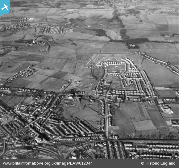
EAW012344 ENGLAND (1947). Crow Lane East, Victoria Road and environs, Earlestown, 1947. This image has been produced from a print.
© Copyright OpenStreetMap contributors and licensed by the OpenStreetMap Foundation. 2026. Cartography is licensed as CC BY-SA.
Nearby Images (3)
EAW012344

EAW012329

EAW012328

Details
| Title | [EAW012344] Crow Lane East, Victoria Road and environs, Earlestown, 1947. This image has been produced from a print. |
| Reference | EAW012344 |
| Date | 26-November-1947 |
| Link | |
| Place name | EARLESTOWN |
| Parish | |
| District | |
| Country | ENGLAND |
| Easting / Northing | 357842, 395963 |
| Longitude / Latitude | -2.6350003566618, 53.458474089101 |
| National Grid Reference | SJ578960 |
Pins

TeeKay |
Sunday 3rd of May 2026 07:24:27 PM |