
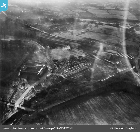
EAW012258 ENGLAND (1947). The Butterley Iron Works, Butterley, 1947
© Copyright OpenStreetMap contributors and licensed by the OpenStreetMap Foundation. 2026. Cartography is licensed as CC BY-SA.
Nearby Images (18)
EAW012258

EAW012247

EAW012264

EAW012244

EAW012245

EAW012246

EAW012263

EAW012260

EAW012243

EAW012242

EAW012257

EPW050252

EPW050255

EPW050251

EAW012259

EPW050254

EPW050253

EAW012251

Details
| Title | [EAW012258] The Butterley Iron Works, Butterley, 1947 |
| Reference | EAW012258 |
| Date | 24-November-1947 |
| Link | |
| Place name | BUTTERLEY |
| Parish | RIPLEY |
| District | |
| Country | ENGLAND |
| Easting / Northing | 440268, 351620 |
| Longitude / Latitude | -1.3990791819887, 53.060008314533 |
| National Grid Reference | SK403516 |
Pins
Be the first to add a comment to this image!