
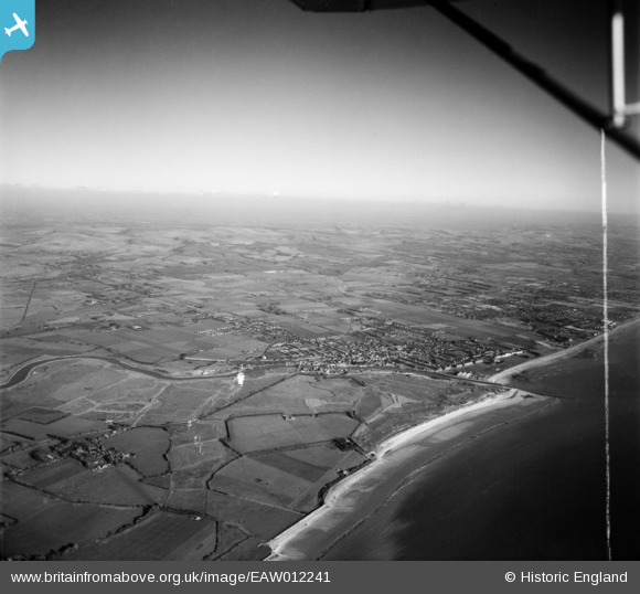
EAW012241 ENGLAND (1947). The River Arun, town and surrounding countryside at Poling, Littlehampton, from the south-west, 1947. This image was marked by Aerofilms Ltd for photo editing.
© Copyright OpenStreetMap contributors and licensed by the OpenStreetMap Foundation. 2026. Cartography is licensed as CC BY-SA.
Details
| Title | [EAW012241] The River Arun, town and surrounding countryside at Poling, Littlehampton, from the south-west, 1947. This image was marked by Aerofilms Ltd for photo editing. |
| Reference | EAW012241 |
| Date | 24-November-1947 |
| Link | |
| Place name | LITTLEHAMPTON |
| Parish | LITTLEHAMPTON |
| District | |
| Country | ENGLAND |
| Easting / Northing | 501935, 101727 |
| Longitude / Latitude | -0.55317402889554, 50.805556792453 |
| National Grid Reference | TQ019017 |
Pins

John W |
Sunday 18th of September 2016 04:08:06 PM | |
|
John W |
Sunday 18th of September 2016 04:07:04 PM | |
|
cptpies |
Friday 12th of December 2014 08:16:12 AM | |
|
JerryE |
Thursday 2nd of January 2014 09:09:53 PM | |
|
JerryE |
Thursday 2nd of January 2014 08:49:06 PM |
User Comment Contributions

Littlehampton AT Blocks |
cptpies |
Friday 12th of December 2014 08:18:41 AM |