
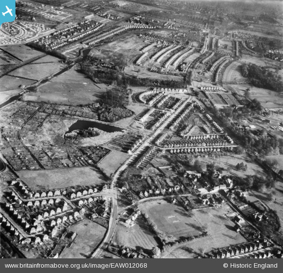
EAW012068 ENGLAND (1947). The residential area off Russell Drive and Tranby Gardens, Wollaton, 1947
© Copyright OpenStreetMap contributors and licensed by the OpenStreetMap Foundation. 2026. Cartography is licensed as CC BY-SA.
Nearby Images (8)
EAW012068

EPW021777

EPW021778

EPW021776

EPW021779

EPW021804

EPW021805

EAW012067

Details
| Title | [EAW012068] The residential area off Russell Drive and Tranby Gardens, Wollaton, 1947 |
| Reference | EAW012068 |
| Date | 5-November-1947 |
| Link | |
| Place name | WOLLATON |
| Parish | |
| District | |
| Country | ENGLAND |
| Easting / Northing | 452705, 340067 |
| Longitude / Latitude | -1.2153838366646, 52.955072254467 |
| National Grid Reference | SK527401 |
Pins
Be the first to add a comment to this image!