
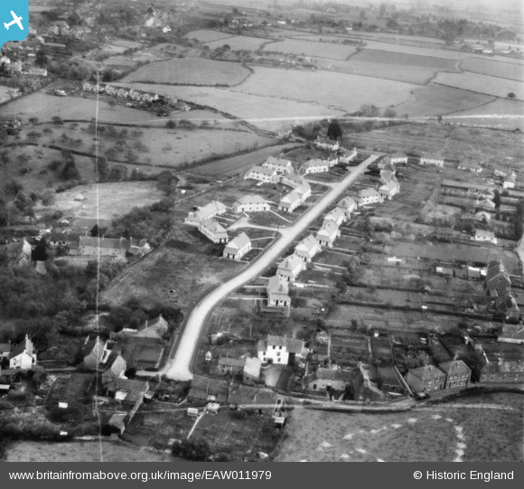
EAW011979 ENGLAND (1947). Houses along Ridgeway, Nailsea, 1947. This image was marked by Aerofilms Ltd for photo editing.
© Copyright OpenStreetMap contributors and licensed by the OpenStreetMap Foundation. 2026. Cartography is licensed as CC BY-SA.
Nearby Images (11)
EAW011979

EAW011983

EAW011980

EAW011984

EAW011981

EAW011982

EAW011978

EAW011975

EAW011985

EAW011976

EAW011977

Details
| Title | [EAW011979] Houses along Ridgeway, Nailsea, 1947. This image was marked by Aerofilms Ltd for photo editing. |
| Reference | EAW011979 |
| Date | 1-November-1947 |
| Link | |
| Place name | NAILSEA |
| Parish | NAILSEA |
| District | |
| Country | ENGLAND |
| Easting / Northing | 346424, 170391 |
| Longitude / Latitude | -2.7707373983942, 51.429496012472 |
| National Grid Reference | ST464704 |
Pins

Gary |
Tuesday 15th of September 2015 05:33:20 PM | |
|
Gary |
Friday 9th of May 2014 10:31:14 PM |