
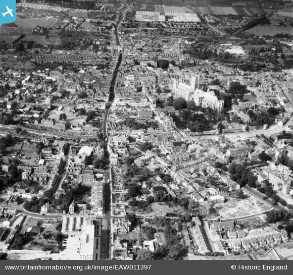
EAW011397 ENGLAND (1947). Christ Church Cathedral and the city centre, Canterbury, from the south-east, 1947
© Copyright OpenStreetMap contributors and licensed by the OpenStreetMap Foundation. 2026. Cartography is licensed as CC BY-SA.
Nearby Images (2)
EAW011397

EAW014334

Details
| Title | [EAW011397] Christ Church Cathedral and the city centre, Canterbury, from the south-east, 1947 |
| Reference | EAW011397 |
| Date | 1-October-1947 |
| Link | |
| Place name | CANTERBURY |
| Parish | |
| District | |
| Country | ENGLAND |
| Easting / Northing | 615374, 157543 |
| Longitude / Latitude | 1.0882933473437, 51.27575054995 |
| National Grid Reference | TR154575 |
Pins

Tom |
Saturday 27th of June 2020 12:28:12 PM | |

Sparky |
Thursday 11th of January 2018 10:17:18 AM | |

Alan McFaden |
Thursday 10th of July 2014 01:58:08 PM | |
|
Alan McFaden |
Thursday 10th of July 2014 01:57:30 PM | |
|
Alan McFaden |
Thursday 10th of July 2014 01:56:42 PM | |
|
Alan McFaden |
Thursday 10th of July 2014 01:55:53 PM | |
|
Alan McFaden |
Thursday 10th of July 2014 01:54:58 PM |


