
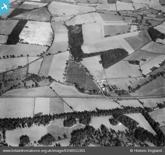
EAW011301 ENGLAND (1947). Bridge Farm and Great Spinney, Rushbrooke, 1947
© Copyright OpenStreetMap contributors and licensed by the OpenStreetMap Foundation. 2026. Cartography is licensed as CC BY-SA.
Details
| Title | [EAW011301] Bridge Farm and Great Spinney, Rushbrooke, 1947 |
| Reference | EAW011301 |
| Date | 1-October-1947 |
| Link | |
| Place name | RUSHBROOKE |
| Parish | RUSHBROOKE WITH ROUGHAM |
| District | |
| Country | ENGLAND |
| Easting / Northing | 587535, 262074 |
| Longitude / Latitude | 0.74601397599527, 52.224492003785 |
| National Grid Reference | TL875621 |
Pins

Matt Aldred edob.mattaldred.com |
Sunday 2nd of March 2025 11:39:50 AM | |
|
Matt Aldred edob.mattaldred.com |
Thursday 11th of March 2021 04:09:33 PM | |

cptpies |
Monday 16th of December 2013 02:03:57 PM | |
PILLBOX: S0006268 |
Matt Aldred edob.mattaldred.com |
Tuesday 15th of October 2019 04:40:11 PM |
User Comment Contributions
Pillbox, Rushbrooke. |
cptpies |
Thursday 19th of December 2013 02:01:10 PM |