
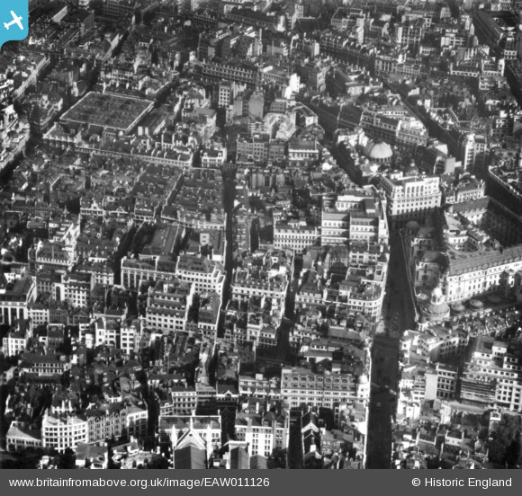
EAW011126 ENGLAND (1947). Lothbury and environs, London, 1947. This image has been produced from a print.
© Copyright OpenStreetMap contributors and licensed by the OpenStreetMap Foundation. 2026. Cartography is licensed as CC BY-SA.
Nearby Images (26)
EAW011126

EAW026320

EAW011193

EAW000512

EAW000496

EPW055312

EAW026315

EAW026316

EAW011192

EPW045394

EPW045395

EAW000497

EPW060546

EPW005754

EAW026318

EAW000499

EPW024274

EPW055357

EPW060547

EAW021729

EPW037970

EPW045432

EAW011127

EAW011175

EAW026313

EAW049464
, London, 1953")
Details
| Title | [EAW011126] Lothbury and environs, London, 1947. This image has been produced from a print. |
| Reference | EAW011126 |
| Date | 30-September-1947 |
| Link | |
| Place name | LONDON |
| Parish | |
| District | |
| Country | ENGLAND |
| Easting / Northing | 532759, 181347 |
| Longitude / Latitude | -0.086507843275376, 51.514944702505 |
| National Grid Reference | TQ328813 |
Pins
Be the first to add a comment to this image!