
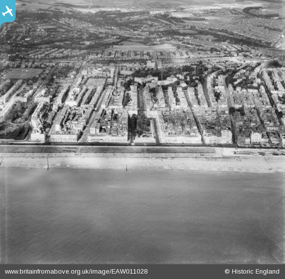
EAW011028 ENGLAND (1947). The seafront and the town, Brighton, 1947
© Copyright OpenStreetMap contributors and licensed by the OpenStreetMap Foundation. 2026. Cartography is licensed as CC BY-SA.
Nearby Images (8)
EAW011028

EPW041374

EPW054139

EPW000518

EAW011027

EPW039538

EPW054034

EPW035292

Details
| Title | [EAW011028] The seafront and the town, Brighton, 1947 |
| Reference | EAW011028 |
| Date | 25-September-1947 |
| Link | |
| Place name | BRIGHTON |
| Parish | |
| District | |
| Country | ENGLAND |
| Easting / Northing | 529746, 104324 |
| Longitude / Latitude | -0.15771144191453, 50.823339601612 |
| National Grid Reference | TQ297043 |
Pins

redmist |
Friday 5th of February 2021 08:23:29 PM |