
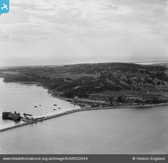
EAW010944 ENGLAND (1947). Bincleaves Groyne, Rodwell and environs, Weymouth, from the east, 1947
© Copyright OpenStreetMap contributors and licensed by the OpenStreetMap Foundation. 2026. Cartography is licensed as CC BY-SA.
Nearby Images (4)
EAW010944

EAW010947

EAW010948

EAW010943

Details
| Title | [EAW010944] Bincleaves Groyne, Rodwell and environs, Weymouth, from the east, 1947 |
| Reference | EAW010944 |
| Date | 24-September-1947 |
| Link | |
| Place name | WEYMOUTH |
| Parish | |
| District | |
| Country | ENGLAND |
| Easting / Northing | 368345, 78058 |
| Longitude / Latitude | -2.4473377314302, 50.600796930352 |
| National Grid Reference | SY683781 |
Pins

Matt Aldred edob.mattaldred.com |
Thursday 11th of March 2021 04:15:05 PM | |
|
Matt Aldred edob.mattaldred.com |
Thursday 11th of March 2021 04:14:32 PM | |
|
Matt Aldred edob.mattaldred.com |
Thursday 11th of March 2021 04:14:14 PM | |
|
Matt Aldred edob.mattaldred.com |
Thursday 11th of March 2021 04:13:58 PM | |

Sparky |
Sunday 1st of October 2017 04:06:48 PM | |
|
Sparky |
Sunday 1st of October 2017 04:06:17 PM | |
|
Sparky |
Sunday 1st of October 2017 04:05:41 PM |