
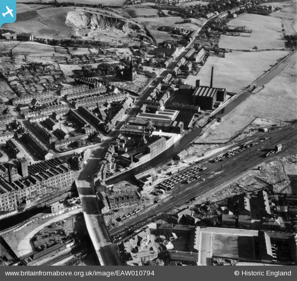
EAW010794 ENGLAND (1947). Whipp and Bourne Ltd Electrical Engineering Works and environs, Castleton, 1947
© Copyright OpenStreetMap contributors and licensed by the OpenStreetMap Foundation. 2026. Cartography is licensed as CC BY-SA.
Nearby Images (12)
EAW010794

EAW010797

EAW010793

EAW010795

EAW010796

EAW010799

EAW010798

EAW010792

EPW016705

EAW010791

EPW016708

EPW016707

Details
| Title | [EAW010794] Whipp and Bourne Ltd Electrical Engineering Works and environs, Castleton, 1947 |
| Reference | EAW010794 |
| Date | 17-September-1947 |
| Link | |
| Place name | CASTLETON |
| Parish | |
| District | |
| Country | ENGLAND |
| Easting / Northing | 388339, 410374 |
| Longitude / Latitude | -2.176184770018, 53.589578269077 |
| National Grid Reference | SD883104 |
Pins
Be the first to add a comment to this image!