
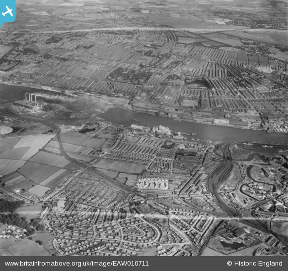
EAW010711 ENGLAND (1947). Dunston, Teams, Elswick and the River Tyne, Dunston, from the south-east, 1947. This image was marked by Aerofilms Ltd for photo editing.
© Copyright OpenStreetMap contributors and licensed by the OpenStreetMap Foundation. 2026. Cartography is licensed as CC BY-SA.
Nearby Images (2)
EAW010711

EAW010710

Details
| Title | [EAW010711] Dunston, Teams, Elswick and the River Tyne, Dunston, from the south-east, 1947. This image was marked by Aerofilms Ltd for photo editing. |
| Reference | EAW010711 |
| Date | 10-September-1947 |
| Link | |
| Place name | DUNSTON |
| Parish | |
| District | |
| Country | ENGLAND |
| Easting / Northing | 422875, 561875 |
| Longitude / Latitude | -1.6428028082691, 54.950920699673 |
| National Grid Reference | NZ229619 |
Pins

redmist |
Tuesday 20th of October 2020 11:54:43 AM | |
|
redmist |
Tuesday 20th of October 2020 11:54:25 AM | |
|
redmist |
Tuesday 20th of October 2020 11:53:57 AM | |
|
redmist |
Tuesday 20th of October 2020 11:53:38 AM | |
|
redmist |
Saturday 16th of November 2019 11:46:14 PM | |
|
redmist |
Saturday 16th of November 2019 11:45:01 PM | |
|
redmist |
Saturday 16th of November 2019 11:44:28 PM | |
|
redmist |
Saturday 16th of November 2019 11:43:47 PM | |
|
redmist |
Saturday 16th of November 2019 11:42:48 PM |