
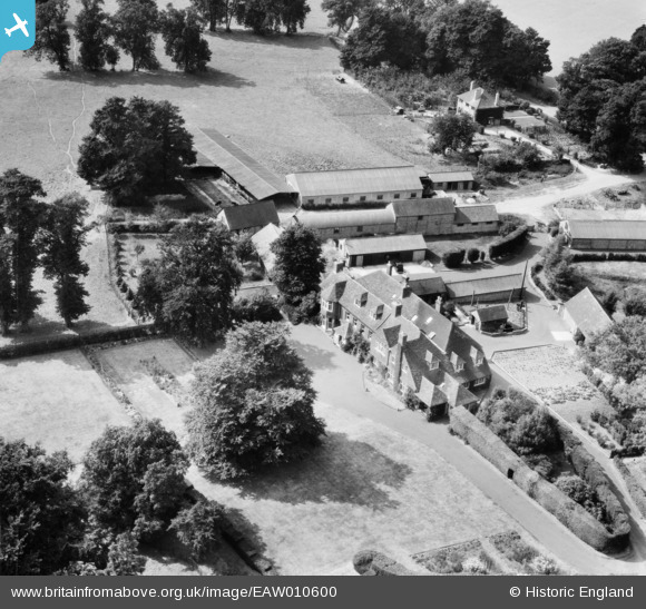
EAW010600 ENGLAND (1947). Hattingley House and Farm, Hattingley, 1947
© Copyright OpenStreetMap contributors and licensed by the OpenStreetMap Foundation. 2026. Cartography is licensed as CC BY-SA.
Nearby Images (5)
EAW010600

EAW010598

EAW010599

EAW010593

EAW010594

Details
| Title | [EAW010600] Hattingley House and Farm, Hattingley, 1947 |
| Reference | EAW010600 |
| Date | 3-September-1947 |
| Link | |
| Place name | HATTINGLEY |
| Parish | MEDSTEAD |
| District | |
| Country | ENGLAND |
| Easting / Northing | 464190, 137172 |
| Longitude / Latitude | -1.0825602198593, 51.12969799292 |
| National Grid Reference | SU642372 |
Pins
Be the first to add a comment to this image!